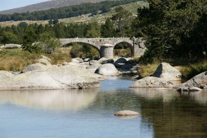
The Tarn river starts on the slopes of Mont Lozère at an approximate altitude 1500 m. For a few kilometres, it flows through a fairly flat mountain grassland plateau with its spongy turf until reaching a narrow gap on the edge of the plateau. From there on it plunges down to much lower altitudes, losing over half of its altitude in less then 30 km. The river then flows through the famous Tarn river gorges and on into more rolling landscapes at still lower altitudes.
The “Pont du Tarn” is the bridge closest to the river’s source and provides a crossing point on the mountain grassland plateau. The bridge was built in medieval times in the ancient Roman arch style from locally sourced granite blocks. The bridge facilitates foot and cycle traffic movements between Mas de la Barque and Pont de Montvert which are about 8 km distant from each other via the bridge, but nearly 50 km distant by regular roads. Shepherds also use the bridge in the summertime when their sheep are in the high pastures. Finally, the bridge is also on an ancient Roman road crossing Mont Lozère from north to south.
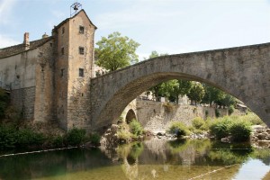
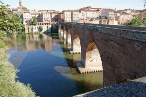
The Tarn river is crossed by numerous other bridges – many of which are ancient. For example, the bridge in Le-Pont-de-Montvert with its defensive tower dates from the 17th century and is not the first bridge on this site. Further downstream, the “pont vieux” (old bridge) in Albi dates from the 10th century and has a long history also related to wars between France and Languedoc in the early middle ages.
However, possibly the most famous Tarn river bridge is the modern “Viaduc de Millau” (Millau viaduct) – not pictured (click here for pictures). The recently completed viaduct is the tallest suspension bridge in the world (pylon height) and 12th highest at road deck level – 270 m above ground at its highest point.


